Traverse of the Theban Plateau, Conclusion: The Interrogation

After a short drive we pull off the road and up to a small portable cabin. The thin guy asks for my passport. Again, I find myself fumbling in my rucksack.

“Don’t worry, take your time.”

Probably due to exhaustion, this is the first time I am conscious of being concerned. No one puts you in a car, asks for your passport, and tells you to take your time unless they’re intending to take you somewhere you don’t want to be. For a long time. But no clearer thought comes into my head other than “They’ve got me”. At this stage I have no idea either of who “they” might be. The thin guy gets out, opens my car door and shows me to the cabin. The only light outside is from the passing trucks.

Hamdy’s car pulls up and the two men emerge, the joy I heard in their voices only thirty minutes ago now drained from their faces. Hamdy looks serious, resigned; Mohsen very concerned. I give them only the briefest of glances. Partly I don’t want to look conspiratorial. But neither can I look them in the eye. It feels useless to speak. What can I do – apologise? Ask what’s happening? No. It’s pointless. In the darkness we just have to let events take their course.

I get into the hut first. A kindly-looking mustachioed man in camouflaged trousers and a T-shirt with “ARMY” on it, stands by a desk. He puts a red plastic chair in front of him and beckons me to sit. Mohsen walks past me and sits almost opposite, and Hamdy takes a seat to the right of me but just out of view. Conversation begins in Arabic, throughout which I cannot make out much more than repeated mention of the word ‘arabeya’ (car). At 7.09 a call comes in from Jenie; the reception is not good but I can tell she is worried. Before breaking up I am only able to give her the briefest details of my situation. As the other men talk I pick up my phone and compose a WhatsApp message to my wife: “Pauline I’m fine but am just having to answer some police questions. I will get back to you as soon as I can xx”. I am relieved, and reassured, when the calm reply comes straight back: “OK xx”.

I ask if I can have a cigarette and Mohsen goes back to the car to get his packet of Rothmans. I’m not sure whether this is to give me something to do while the men are talking, to calm my nerves, or because it’s what you would do in a film. I am too tired, and adjusting quickly to events, to make sense of either my thoughts or emotions. The army guy asks if I would like tea and the thin guy goes to get it. I sit there dragging on the cigarette, exhausted. The conversation between the army man, Mohsen and Hamdy continues uninterrupted. After some ten minutes or so, Army man asks me, in broken but reasonable English, what I was doing in the desert.

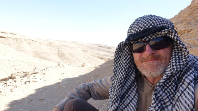
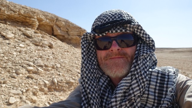
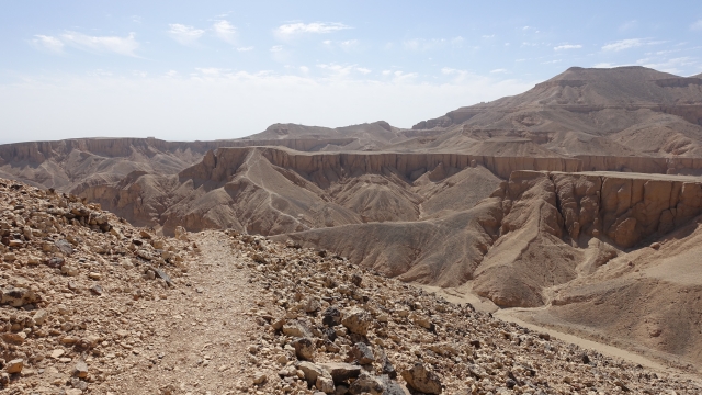
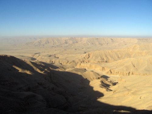
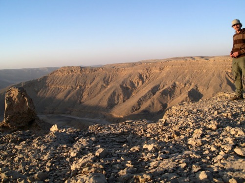
I tell him that I was “walking across the bend”. He informs me that the desert is ‘a military area’. That’s news to me. I say “sorry” and then attempt to follow this up with Arabic, but instead of “Ana aasif” (I’m sorry) say “Ana aarif” (I know). I am immediately aware of my mistake and resolve to keep to English. I catch Mohsen’s eye and he gives me a quizzical look. I further resolve to say as little as is required in case I contradict anything the two cousins have already said.

I’m conscious that I am unable to look at Hamdy, partly because he is out of my direct line of sight. But mainly because I am starting to feel faintly sick at the thought that I might have fucked up both of their lives, and those of their families – for what trivial, selfish purpose?  I glance at my passport on the table and the two Egyptian identity cards between Army guy’s fingers. Our fate is in his hands. For their part the very least it could mean is confiscation of their licences to work and with it, financial ruin. Things are hard enough as it is. A wave of feeling passes over me of the potentially grave consequences of little things, small incremental decisions. More immediately, what concerns me is that this seemingly nice guy could just be the ‘good cop’ prelude to a very long and unpleasant night…and whatever else to follow. This man has the power to make the lives of at least two of us take a significant turn for the worse.

But just at that moment I detect that the mood is lifting and there is a hint of a smile on our inquisitor’s lips. He tells me more about the military zone. There is a feeling of things starting to come to a conclusion. He asks us each to give our full names and enters them on the page of a desk diary. He has a bit of trouble with my name. “Tim”. “Cooper”. And what is my family name? “Cooper”. I suggest he takes it from my passport but he doesn’t seem to think it necessary. The passport and identity cards are returned to their owners. I notice Mohsen relax a little.

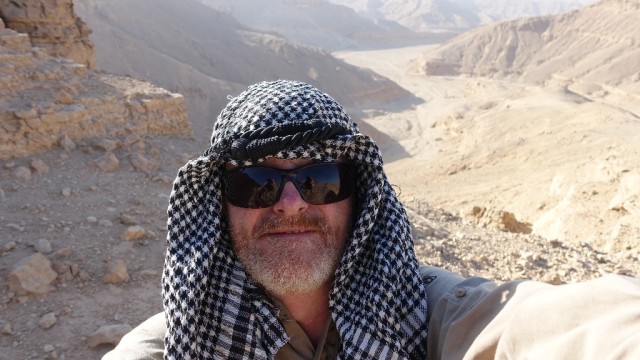
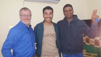
As I finish the tea, the army man addresses me directly: “Mr Kooba, please update your maps to show that this is a military area”. I assure him that I will. Things are quite chatty now, and I can see that my friends are smiling. It feels like it’s been about forty-five minutes to an hour, but I’m not really sure. As he beckons us to rise, I am now fully aware of being physically, mentally, and emotionally drained and I am taken by surprise when he asks us for a selfie before shaking my hand warmly, saying it was a pleasure to meet me, and seeing us off on our way. For my part, I thank him for the tea. I don’t need a passport to prove that I’m British.

٢٠١٧٠٢٠٩_١٩٥٠٤٢٢٠١٧٠٢٠٩_١٩٥٠٢٣

Back on the road to Luxor things are quiet in the car to start with. We are all assimilating what has happened over the past two hours. I lean forward and tell the guys how sorry I am for getting them into this but they already seem cool about it. “Let’s celebrate at our favourite fish restaurant!” Hamdy enthuses, “It’ll be the best fish you’ve ever tasted!” Reluctantly I put this off till tomorrow. I am just too tired. My only thoughts now are of a shower and a bed. And sending messages to Pauline and Jenie. In the case of Jenie I also try to call her, but lose signal repeatedly. The message will have to do till now.

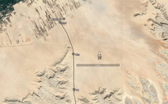
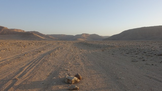
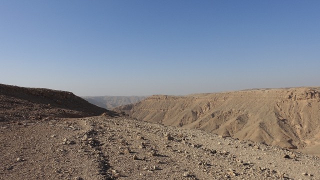
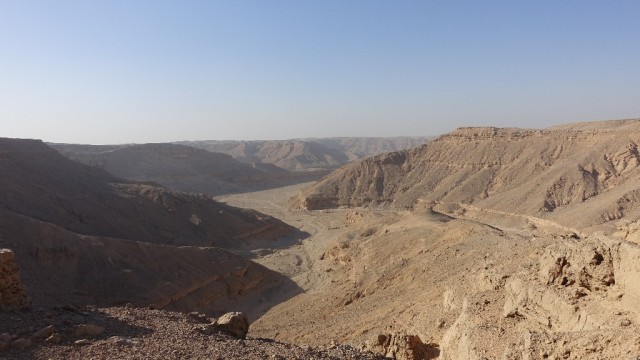
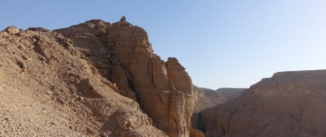
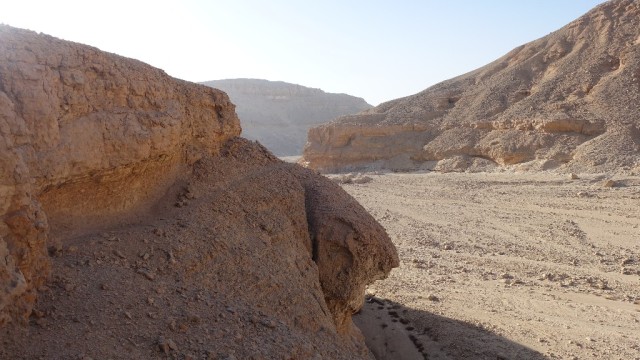
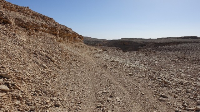
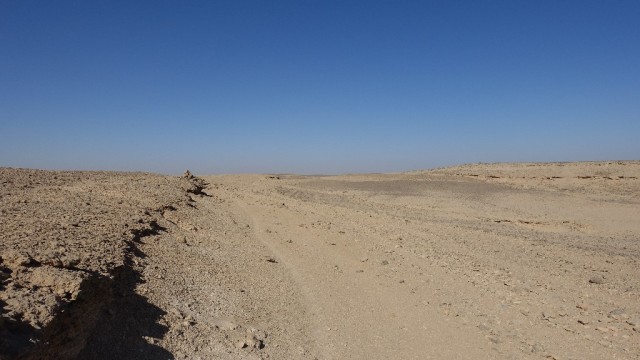
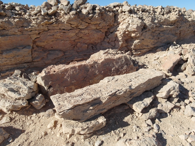
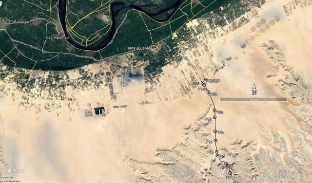
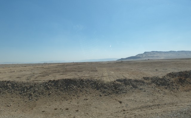
In the car, the earlier tension has relaxed and smiles break out. There’s a feeling of Thelma and Louise, but for guys. The cousins tell me the outcome could have been very different. All had been going quite well for the pick-up but when they set off to drive towards me they went up the wrong desert track and bumped into an army unit that included the man with the bulldozer. The army had already seen their flashing headlights and my light emerging from the desert and they were under suspicion of being the two fugitives involved in the recent shooting at Nag Hammadi; of being involved in antiquities theft from the valley down which I was walking; and of assisting someone to enter a military zone.

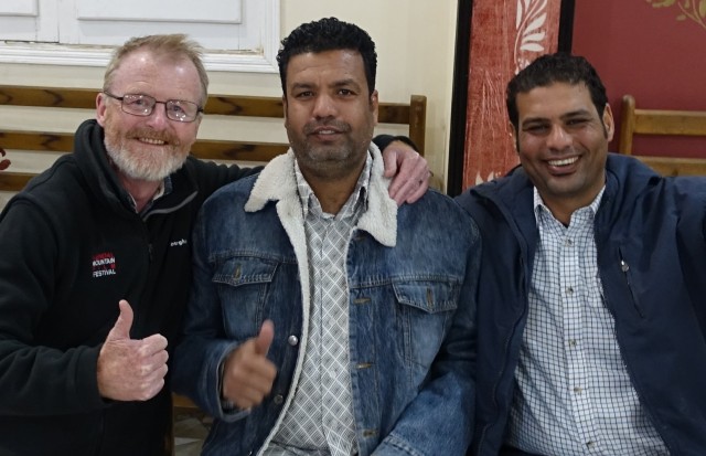
“We are lucky it was the army captain that questioned us and not his boss” Hamdy says gravely, to which Mohsen adds “And lucky that it was the army we ran into rather than the police. The police would not have been so kind to us”. The accusation of being the two gunmen was cleared up first as the guys’ ID cards showed they were from Qurna, not the same village as the suspects. “And the captain had been to school there, so he immediately felt friendlier towards us!” Mohsen laughs. As for the other two charges, these rested on my identity and motives. The guys had spent most of the interrogation convincing the captain that I was a “well-known British writer” on an expedition that I was going to write up in a book on my return to England. “That’s why he wanted the selfie!” Hamdy reveals and there are laughs and high fives all round.

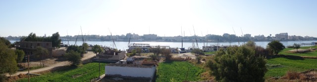
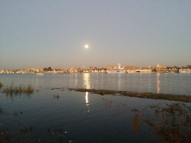
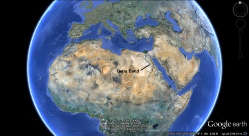
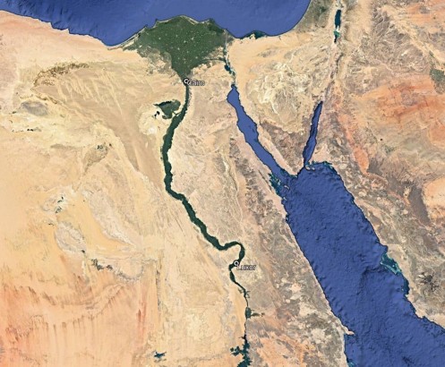
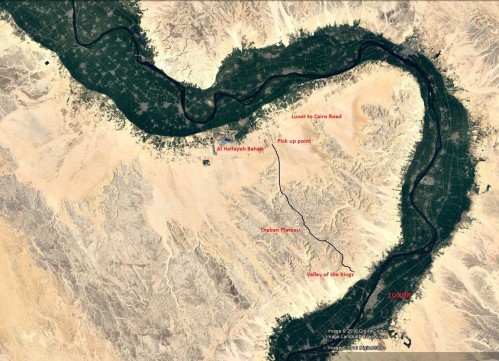
Looking out of the window I can just see through the enveloping darkness that we are starting to turn the Qena Bend. Soon we would be getting closer to the Nile, then following the desert road back to our respective homes on the west bank at Luxor. I feel tiredness and emotion start to consume me.

It’s been a long day.


[Header image: When2Trip]


Posted in Desert, Egypt, Landscape, Luxor / Thebes | Tagged , , | 3 Comments

Traverse of the Theban Plateau, Part Eight: The Expedition (4)

Soon after reaching the flat valley floor the realisation overtakes me that the 11km remaining to be walked across the flat sandy plain constitute about a quarter of the whole walk. Almost the same distance from where I had gone wrong to the place I now sit. And if I’d not gone wrong I would almost be with the boys by now (I had told them to expect me any time after 4pm). Instead, even walking flat out it was going to be dark before I got to them. There is only time for a short rest, a bite to eat and some water, and to put a plaster on a blister that had developed on the sole of my right foot. But I do allow myself a moment to take in my surroundings, which are sublime; the line of limestone cliffs off to my right, especially, inspire awe. It is obvious why this place was sacred to my Ancient Egyptian predecessors who came here from their homes in the Nile valley to be at one with Hat’hor, goddess of desert mountains. And of love.

Then it is off across the final flat sand walk-out in a race against the setting sun. The track along the valley floor is not particularly distinct but it is obvious which way I have to go; it’s essentially a case of following the GPS. Sometimes I follow a vehicle track; at others the original camel trail is on firmer ground. As I get beyond the penultimate spur the ground becomes more level, but also more variable, and at times I curse as my feet sink into soft sand. The rocky promontories to my left look wonderful with the sun setting behind them. I may be tired and aching, but this is my kind of desert landscape, and it still thrills me.

All along the trail are the footprints of the wolves or jackals that come down from the upland wadis into the valley at dusk; perhaps the feeling that they are hard on my heels is another contributor to making my best pace of the day on this final stretch. After a few adjustments, the route after F14 is fairly straight. But it is determined walking, ignoring the pain, occasionally cursing soft sand, hoping for no last problems. By F15 the moon has risen as darkness descends. I switch on my head-torch, not because I need its light but so that Hamdy and Mohsen can hopefully see my approach. From 15a, after passing a small brick building on the right, it is straight along a recently-made vehicle track. Ahead I can see the lights of vehicles on the desert highway between Cairo and Aswan. The end of the journey is in sight.

Approach to pick-up

Final walk-out across sand and gravel plain to destination. F14, F15a, “Road” and “Pick-up” waypoints marked. 5km scale.

DSC01210

Looking back from the final gravel plain towards the plateau which I have spent the day crossing.

DSC01209

The setting sun casts a long shadow as I take the final photo of the day, of the moon rising in the east. My destination is still 9km away to the left of the photo.

As I get closer to the road I can see the headlights of a stationary car in a position that would correspond with the pick-up point. My heart starts to beat faster. A little further on I get my first mobile phone signal and at the second attempt manage to make contact with Hamdy. There is a great outburst of emotion as they realise I am almost with them and, on my part, at the great effort almost being over and the anticipated joy of being reunited with my new friends. As a final check I get them to switch the lights off and on -it’s definitely them!

As I get closer to the highway the volume of traffic becomes apparent and the rush and honking of trucks is the first sound I have heard for twelve hours. Also apparent is the lack of any verge or hard shoulder, and what a menacing proposition is the final few hundred metres’ walk to the pick-up point now it is in complete darkness. Concerned for my safety walking beside the highway I call Hamdy again and, with some difficulty due to intermittent reception, ask him to drive towards me. I think he has understood. I wait at the end of the track holding my head-torch for identification. I stand there for some minutes but there is no sign of a vehicle. I call Hamdy again. When I get through, his voice is flat and without emotion, in complete contrast to the unbounded joy of a few moments before.  “We are talking to the police.” The signal breaks up.

I start walking along the road towards the pick-up point. It is everything I was trying to avoid by finishing the expedition in daylight and is easily the most frightening part of the undertaking. Occasionally I can make good progress along the edges of fields; in other places I am clambering in the darkness over hillocks of rubbly sand, all the while trucks rushing past me, often (in the Egyptian way of things) with no lights on. Eventually the arrow on the GPS points to my left, indicating the pick-up point. My first thought is to wonder at the accuracy of being able to follow a 40km trail across desert mountains to this very spot by the side of a busy road. My next thought is to getting across the busy highway in one piece.

Standing with my head-torch in hand at the turn-off which was the original pick-up point, for the first time in the day I feel truly vulnerable, vehicles careering past at high speed along an unlit highway in the country with the worst road death statistics in the world. The car is not there. After some five minutes a vehicle with high-mounted headlights takes the turn-off and heads straight for me; I jump to the side and it comes to a halt. It is a bulldozer, of a type commonly used in Egypt for sand-clearing work, its cab in the form of a cage. To my surprise the voice of a young man in the cage calls down to me.

“You Briddish?”
“Sorry?”
“You Briddish? You with Egyptian men?”
“Er, yes”. My heart is pounding.
“Passport.”

Things are getting worrying very quickly. I fumble in the top of my rucksack and – somewhat dazed – hand the document up to a part-obscured digger driver. I think: that’s my passport, what am I doing…. what’s happening? Who is he? I feel partial relief when he hands it straight back to me. But not for long. Across the road I see a pick-up truck slow to a halt, closely followed by what I recognize as Hamdy’s Toyota saloon. The pick-up door opens and one of a type of Egyptian young man appears; slim, in over-tight quasi-military clothing. He looks both ways before crossing to my side of the road.

“Get into the car please.”


Posted in Desert, Egypt, Landscape, Luxor / Thebes | Tagged , , | Leave a comment

Traverse of the Theban Plateau, Part Seven: The Expedition (3)

During the rest of the walk across the plateau there is unfortunately little time for taking real pleasure in my surroundings. Following the initial disappointment that I am yet to make it to F5, my first ‘unreached’ waypoint on the plateau, it is a case of making a good pace from one waypoint to the next. Disappointment is soon followed by the realisation that the journey to F6 is one of the longer legs of the expedition. In the back of my mind I am also wary of getting too tired mid-plateau so I make sure I make regular use of my various energy snacks.

There are one or two moments on the way to F7 where the way isn’t absolutely clear, and I find myself mildly cursing my earlier error, but generally I remain positive, determined and level-headed. From my desktop surveys on Google Earth I somehow expect the way from F7 to F8 to be clearly descending, and possibly with the final spur visible from a distance, but neither of these is actually the case on the ground. To all intents and purposes, it appears that I am still heading into endless flat terrain and I realise how great will be my relief, rather than the elation I originally anticipated, when I do finally reach the end of the high desert before descending once again into the Nile Valley.

DSC01198

Approaching F7a, three quarters of the way across the plateau, 8 hours 10 minutes from the start. Note the trail here made up of  a number of distinct camel tracks, evidence of past caravans using the route.

On the approach to F7a the route goes along the side of a small tongue of wadi and then up over a small hill and again I find myself mildly cursing that the trail is not as distinct as I would like. This is one of a few moments on the way across the plateau where I tell myself that I am ‘not out of the woods’ yet. Before going over the hill, I take advantage of some shade from a small overhanging rock, refuel and take a couple of photos. It is the first time since going off course that I allow myself to be immersed in the experience. The silence is total. It is one of the main things that has brought me here. On setting off again, at a small section of soft ground I come across the only set of footprints I have seen apart from my own, almost certainly those of the German, ‘Faruku’. This is the other reason I am here: to experience complete solitude.

DSC01196

Brief rest stop in the shade of an overhanging rock. ‘The silence is total’.

As the ground does begin to lose height, the descent towards F8, the final waypoint on the plateau proper, is not quite the ‘coming down from the mountain’ experience I had imagined. I am also surprised that Gebel Roma (the name the American archaeologist Darnell gave to the final spur) is not as distinct as I was expecting from both his photos and those of ‘Faruku’. In fact, I only notice its distinctive summit block when I have passed it, possibly distracted by the immense scatters of ancient pottery that cover the ground at this end of the trail.

DSC01201

A shot close to the one taken by Faruku. But unlike him, I missed the big block of Gebel Roma as I passed it.

DSC01202

First sight of the valley floor from the northern end of the plateau.

DSC01203

What should have been the ‘elation’ shot but instead was more like ‘relief’.

DSC01204

Looking back at Gebel Roma with its distinctive summit block. The descent from here was more problematic than I had imagined.

Nor is the descent from Gebel Roma as straightforward as I had imagined it to be, again highlighting the limitations of ‘exploring from the air’. Although there seems to be a rather indistinct track off to the left, I follow the arrow straight down the spur to my final upland waypoint, expecting a relatively easy descent. Instead, when I meet a path again, it is hugging the edge of the cliff, just like the one along which Almasy carries Katherine to her final resting place in The English Patient. Below is a drop of some twenty metres, and after a minute or two of shuffling along the narrow path it comes to an abrupt end.

Turning back up the rocky spur I give inner vent to my frustrations: “You mean, you’ve come all this way – you’ve walked for almost ten hours – and the path ends in a fucking sixty-foot drop?!! I can SEE the flat valley floor below me but there’s a sixty-foot drop??” It isn’t long before I remember that this was a trail used for centuries by armies of men, horses, and camels. There must be an obvious turn-off that I have missed. Again.

DSC01207

Narrow path at the end of the final spur, with a twenty-metre drop to its outside.

As the sun starts its descent behind the cliffs and I contemplate being benighted at the very physical end of the hills, I am close to the emotional end of my tether. But a clear head is needed as I scramble back up the rubbly slope. Halfway back up the spur I notice that the loose rocky ground, indicative of a trail, is heading off to the right, though again it appears to be heading straight for a cliff. But the sun is getting lower and I must take it, must take my chances. Remarkably, when I reach the rocky band where the trail appeared to end I find that there are steps cut into the rock. Steps wide enough to allow the horses of Tutankhamun’s armies to pass this way. My head reels. Within another five minutes, at twenty past four in the afternoon, I set foot on the valley floor and kiss the ground in thanks.

DSC01208

‘I set foot on the valley floor and kiss the ground in thanks.’

Posted in Desert, Egypt, Landscape, Luxor / Thebes | Tagged , , | Leave a comment

Traverse of the Theban Plateau, Part Six: The Expedition (2)

When it hits me that I must have gone off course there is a feeling of frustration but I know I must remain calm. I lay my rucksack down on the gritty sand against a low rocky bluff, and collect my thoughts. There is no need for panic as I can see from the GPS that I am still within 2km of the next waypoint at F6, albeit moving steadily away from it. It is approaching 11.00 and I have been out on the plateau some four and a half hours.

The first thing is to prepare myself for the fact that I am going to be out in the full heat of the day for longer than I would have intended, so it’s time to exchange the woolly hat for keffiyeh (Arab head dress). It is at this stage that I take in the fact that weather conditions are perfect, with a temperature in the low twenties and a gentle, cooling breeze, just sufficient to make donning the flapping head gear a little difficult. Once I am walking again, however, it proves to be an excellent piece of kit, keeping the strengthening sun off my head while allowing cool air to get around my face and neck.

DSC01195

I decide that the obvious course of action is to retrace my steps and look for a trail to the north-east that will connect with F6. A little way back I had noticed that after a small spur there was what looked like a single camel track heading in that direction. When I get back to that position I mark a waypoint as ‘cross’ (for crossroads) and set out to follow the tracks across the fairly featureless terrain. Frustratingly, however, the little trail soon disappears, so instead I follow the direction of the arrow straight across country. After about 400 metres I find myself scrambling up a rocky slope until….the inevitable. From the higher ground I can see that I am approaching a wadi; nothing massive but, nonetheless a feature that would take some negotiating. And what if there were more obstacles like this over the course of the next two kilometres, all to be worked around in the full heat of the day?

At this point I seriously regret my decision, in the absence of maps of the plateau, not to bring print-outs from Google Earth. At a late stage in preparation I had decided that these might be difficult to consult in the event of strong wind and it would be better, if needed, to use screenshots on my phone instead. In the event – inevitably – the glare of the sun is much more of a challenge than wind would have been. I decide to return to the cave where I can stop and look at the phone more clearly. On the way there I start to realise how far I have wandered off course. At the same time, on reaching the cave I am comforted by how calm and clear-headed I feel.

The GPS image on my phone screen shows that I am on a north-eastern tongue of one of the big western wadis which appears to be a well-worn groove joining up again with the main route. However, stepping outside onto the loose rubble that fills the narrow gorge, neither my GPS unit nor conventional compass appear to confirm the right direction. Instead of losing more time route-finding I decide to keep retracing my steps to the point where the trails diverged. Before setting off, and after taking some refreshment, I mark ‘cave’ as a waypoint to potentially return to should I need to spend the night on the mountain.

On returning home I was able to reconstruct the path I had taken, from my ‘cross’ and ‘cave’ waypoints and could see that it was a north-western offshoot of the trail marked on the 1920s British Survey map as the Darb Naqb el Ramla (Road of the Sandy Pass) and that the divergence of this and the Farshut Road was clearly marked. I put my not noticing it down to the fact that, before this map had become available online a few weeks before departure, my sole means of tracing the route across the plateau had been Google Earth, on which the divergence had not been apparent (“You can’t explore form the air, Madox!”). I was also able to confirm that following the tongue of the wadi northwards from the caves would indeed have taken me back to the correct route and saved a detour of some 4½ km, about an hour’s walking.

Wrong turn for blog

Route taken in error marked in red, Farshut Road trail in black; ‘cave’ and ‘cross’, F5 and F6 GPS waypoints marked; potential route from ‘cave’ back to the Farshut trail marked in blue. Scale 2km.

1001829_SEGY_Luxor_1933 close up Large e-mail view

Detail of 1920s British Egypt Survey map with circle highlighting divergence of Farshut Road (here marked as Darb al Quraniya) and the Darb Naqb el Ramla taken in error.

After a fast-paced march of some 2km I come to the point where the trails diverged. Apart from a row of small cairns on the high ground to the right it is barely distinguishable. I check my watch: the error has cost me the best part of two and a half hours. The main part of my plan, to be off the plateau before the full heat of day, is now thwarted. There will be no time for proper rest in shade before the final walk across the sand plain at the northern end of the route. Indeed, the expedition has now become a race against the clock to meet up with Hamdy and Mohsen before 6pm.

Before nightfall.

Posted in Desert, Egypt, Landscape, Luxor / Thebes | Tagged , , , , | Leave a comment

Traverse of the Theban Plateau, Part Five: The Expedition (1)

“You can’t explore from the air, Madox. If you could explore from the air, life would be very simple.” Count Almasy (Ralph Fiennes) in “The English Patient” (1996)

Thursday 9th February, 2017

Hamdy pulls up outside the apartment as arranged just after 5.30 and calls me on his mobile. I tell him I am just fixing some last bits of kit and will be down in five minutes. Outside, it is still dark and the air retains some of the freshness of night. On the way up the road we confirm final arrangements and I check that he has the GPS unit and spare batteries. Just in case. On the open ground by the old alabaster factories the balloons are being fired up. There is a general anticipation of adventure.

No questions are asked at the checkpoints into the Valley of the Kings, and at almost exactly 6 a.m. Hamdy stops the car at the near side of the car park by the entrance to the Western Valley. This is the crucial moment. I must get out of the car quickly and walk straight into the side valley; the police jeep is parked less than 25 metres away by the ticket office. I open the back door, pick up my rucksack and turn to go. But it is too late – out of the corner of my eye I see a man approaching, the dark blue uniform of the tourist police, a machine gun.

“You need ticket, you need ticket for Tomb of Ay!” He is walking quickly himself and calling out as he goes. My lips are dry.
“Er, yeah…yes. Ticket Office, right?” He points in the direction of a place I know well. At the ticket office window I anticipate the routine in these days of low tourist numbers. The balding man looks up and smiles.
“Ticket for Ay please”
“Thirty. And you are the first person in the Valley this morning, that is so special for you! And something for me?” I give him fifty and he smiles again.

I nod at the policeman who is now standing by the jeep checking his phone. Back at the car I tell Hamdy that if he doesn’t hear from me within twenty to thirty minutes then it means I am up out of sight and he can start getting ready for the pick-up on the other side. My smile this time is a little nervous as I turn away.

Just as rehearsed two days before, I walk purposefully towards the right into the northern offshoot of the Western Valley. Given the police presence, I make a quick decision to try an alternative trail a little more out of sight that I have traced on Google Earth, and set the GPS to ‘WV2’. I follow the pointer around a spur and into a small wadi. But after some ten minutes of searching I cannot find the start of the path and decide I can’t waste any more time. I will have to take my chances, retrace my steps, and hope that the policeman is still distracted by his phone and not looking this way.

Map of WV Start

Tourist car park for the Valley of the Kings, with route of ascent to plateau highlighted.

As I approach the floodlight housing which is the main marker for the path upwards, and the first place to get out of sight, I quicken my pace, pause a moment behind the stone structure, take a breath and then walk determinedly up the exposed spur, all the while sensing the possibility of unseen eyes on my back. Five metres, ten, fifteen, twenty…the half-expected shout doesn’t come. The ground levels slightly and I know from my earlier visit that I am now out of sight of the car park. The slope steepens again, uneven rubble, every fourth step a slight slide back, but after some fifteen minutes of effort I reach the junction with the main Farshut Road trail. Soon the first rays of sun reach over the cliffs of the Valley of the Kings and strike my sweating back. I feel elated; the main danger is averted. The plateau – the day’s expedition – is mine!

The isotonic drink I had sipped all the way up onto the plateau means that I reach the Lion Bench at 7.25 full of energy. The breeze is a little stronger than on Tuesday’s reccy, but nothing like the icy blast of 2015. After taking on some food and salt I put on my windproof top and woolly hat and set off across the undulating stony ground. For the first few kilometres the trail is at its widest and roughest and it is easy to imagine that you are on a route used by ancient Egyptian armies. I am excited to reach F4, the furthest I have explored so far, and take another brief rest at the Big Cairn, noting with interest the mass of broken pottery that suggests this was the site of an ancient water dump used by generations of fellow-travellers in the distant past.

DSC01188

On the way to F5 the going becomes easier and I feel cheerful and confident as I round the top of one of the big southern wadis and take another brief rest by a rocky overhang that has all the signs of being a rest-stop used by ancient nomads. I think of my brother John who had sent me an unexpected but very welcome ‘good luck’ message just before I’d set off for Egypt, then take a couple of photos of the trail straightening and stretching into the distance.

After about another half hour of walking I notice that the ground is starting to descend, a little more than I was expecting. I check the GPS and notice that the arrow for F5 is pointing towards the right which I put down to the fact – from memory -that this part of the trail has a bit of a kink in it before turning again towards the north-west. The trail is still quite distinct, characterised at this point as a series of parallel camel tracks, each little more than 30cm wide.

DSC01184

‘…a rest-stop used by ancient nomads.’

DSC01192

‘…the trail straightening and stretching into the distance.’

About 2 km further on, the track passes through the head of a wadi, on either side of which are pairs of caves cut into the rock, presumably in ancient times, to provide a resting point along the route. As I pick up the steep path leading out of the rocky cut it occurs to me that it is strange that such a distinctive feature had not been mentioned by either of the two previous explorers whose accounts of the traverse I had read. Soon the ground levels out once again and starts to turn to spongy sand. In the distance ahead are one or two noticeable rises, but generally the trail is still descending so I check the GPS again. F5 is showing as if behind me, yet the tracks are still quite clear. Have I perhaps entered the waypoint incorrectly? I decide to navigate to F6. This, too, is showing itself to be some 2km off towards the right. Presumably there must be a change in the direction of the track at some point ahead so I carry on walking for another fifteen minutes or so, yet the arrow keeps pointing resolutely to the one side. I slow my pace and gaze into the distance where I can see that the camel tracks are leaving the plateau and descending into another wadi system. I start to gather my thoughts and put everything together.

There is only one way of making sense of all the facts. I have lost my way.

Posted in Desert, Egypt, Landscape, Luxor / Thebes, Valley of the Kings | Tagged , , | 2 Comments

Traverse of the Theban Plateau, Part Four: Reccy of El Qurn Start

Wednesday 8th February, 2017

I’m up early again and on the bike to check out the alternative ascent onto the plateau via the summit of El Qurn, a walk I have done a number of times without problems in the past. But when I get to the Queen’s Valley road, a little after 7 A.M., some men waiting by the tourist bazaar catch sight of me as I start to walk the bike in the direction of the workmen’s shrine of Ptah and Meretseger, my preferred starting point on previous occasions. They shout across to say the path is closed, I cannot go that way, so instead I take the road up to the ancient workmen’s village of Deir el Medina. But on the way I catch sight of a sign of things to come: a series of brand new CCTV cameras on posts stationed along the stepped route up the mountain. I lock the bike up by the side of the road opposite the start of the steps, but again I am seen, this time by a man who tells me I must take the bike up to the tourist police depot further up the road. There the police chief, a kindly-enough man, asks me about my intentions and, pointing up the slope, I tell him that I am going to take photos of the hot air balloons. “And the sun!” he responds cheerfully.

But no sooner have I gone up the very first small flight of steps than a pair of tomb guardians appear and tell me I can go no further: the mountain is “closed”. I tell them I have been up many times before but they insist it is no longer possible, and as they are talking I notice that in addition to the ominous line of cameras, both of the old guard stations higher up the hill have been replaced by new facilities painted in the ubiquitous sand colour of the Egyptian Army. Security has indeed been stepped up, just as friends like Jenie and Emad had warned me. Reluctantly, after taking the requisite sun/balloon shot, I return to my bike and the police chief confirms the situation. My first reaction is a sadness that the sacred mountain that I love has been defiled in the name of the “War on Terror” and I may never be able to stand on its hallowed peak again. More immediately, I now know that there is just one direct route up onto the plateau – by avoiding the police presence in the Valley of the Kings and taking yesterday’s ascent from the floor of the Western Valley.

DSC01182

‘a pair of tomb guardians appear and tell me I can go no further…’

The rest of the day is at leisure so I take a boat across the Nile and, for old times’ sake, pay a visit to a Luxor institution, the old bookshop of Gaddis & Co. It is a sign of present times how quiet the shop is, just one or two other customers silently browsing the diminishing stock. I buy a book called Traveling through the Deserts of Egypt which seems an appropriate souvenir of this trip.

IMG_20180315_0001

Gaddis & Co., underneath the Winter Palace Hotel at Luxor.

Back at the apartment I make final kit decisions. Following Tuesday’s reccy I decide to increase the amount of fluid I will carry, from 4.5 to 6 litres, including two half-litre bottles of isotonic drink for sipping during the period of maximum exertion on the ascent to the plateau. Outside on my balcony overlooking the Nile I enjoy the pleasant breeze coming off the river and hope that it won’t be too much stronger up on the plateau.

DSC01446

Before going to sleep that night I start reading ‘Deserts of Egypt’ and stop at the passage quoted earlier: “You have the impression of looking upon places so stark and fresh that they can never have been seen before. By seeing them you create them; they owe their existence to you.” I feel calm and focused on the goal.

I am ready.

Posted in Desert, Egypt, Landscape, Luxor / Thebes | Tagged , , , , | Leave a comment

Traverse of the Theban Plateau, Part Three: Reccy of Western Valley Start

After route-finding difficulties on the 2015 expedition I decide to try out an ascent to the plateau via the Western Valley adjunct of the Valley of the Kings.

Tuesday 7th February, 2017

I am up at dawn to cycle to the Valley of the Kings. As usual, there seems to be an inverse equation between the extent to which people tell me security has been stepped up and the situation that I find on the ground. On this occasion it is probably as relaxed as I have ever seen it in nine years of venturing into these hills. As I enter the valley on my rickety rental bike there is barely a glance from the armed police at the two checkpoints. I lock up the bike against the railings by the tourist market as usual and walk across the deserted car park, keeping half an eye on the police jeep by the main tourist entrance.

HPIM9242

The Valley of the Kings from the south. The Farshut Road can be made out as a white scar near the tops of the hills in the background, reaching the plateau soon after the conical hill at centre (photo 2008).

No one stops me as I enter the Western Valley but as I bear right onto a gravel mound I am seen by an old tomb guardian. As expected, he asks if I am looking for the Tomb of Ay but I give him my well-rehearsed routine, that I am just going up the slope a bit to take photos of the hot air balloons taking off against the rising sun. He says the police do not allow people up there, it is dangerous, to which I tell him that the police have let me do it in the past. He looks me up and down.

“Then will you come with me to the Tomb of Ay – in ten minutes?”
“By the time I have been up and down it will be more like half an hour.”
“Promise me, you will come with me then to the tomb.”
“I promise.”

I turn and glance down at the GPS. The waypoint “WV START” is bang on and soon I have scrambled up the steep scree slope to where it meets the main Farshut Road coming up from the entrance to the Valley of the Kings. On the way up I notice that the huge stone floodlight housings, put in place a few years back, will be a good place for me to hide out of view, if needed, on the day of the traverse itself.

DSC01166.JPG

Mist in the Nile Valley in the background and a hot air balloon rising with el Qurn to its right as I reach the point where the steep track from the Western Valley meets the Farshut Road. In the middle ground, behind the cliffs, is the Valley of the Kings.

I reach the “Lion Bench”, first landmark on the plateau, at 7.45. There is only a light breeze and it is considerably warmer than the last time I was here, the failed attempted traverse of 2015. Getting up the first steep slope had been hard work and as I swig from my water bottle I half-notice that almost one of the two litres I am carrying has now gone, but this fails to make any great impression on me. I take a salt lick and try sending a test text message to Hamdy but it doesn’t look like it gets through. But I am able to get a good GPS signal on Google Maps to back up my Garmin which works on waypoints only.

SAM_2584 (2)

The “Lion’s Head” – first resting point on the plateau.

SAM_2585

The “Lion’s Bench”

At the gypsum outcrops familiar from previous sorties onto the plateau I see great numbers of paw prints and scratch marks made by the jackals / wolves that live up here. It seems strange that I didn’t notice these on previous occasions. I am making good progress – a steady 5 kph – and decide to press on to F4, eight kilometres into the traverse and the furthest point that I reached in 2015. I have a rest at the big cairn and a small hoverfly alights on my rucksack. It is curious how much of a bond I feel with the only other life-form that I know is up here with me. “Hello hoverfly – what are you doing up here?” What I am doing is talking to an insect. I get a satellite fix on Google Maps and take a screenshot that I can analyse back at base. I contemplate the fact that, as the crow flies, I am 25 km from the pick-up point on the northern side. I feel a warm sense of anticipation that the traverse that I have scheduled for two days’ time will be a success.

DSC01173

Paw prints at one of the gypsum outcrops, with my hand-held GPS unit for scale.

20170207_091348 (2)

Hoverfly

Before setting off on the return walk I take a big swig out of the second of my water bottles and, again, only subconsciously register that I have just a quarter of a litre left. But within minutes of starting back I begin to feel quite nervous, and for the first time that I have walked in the desert the reality that I am out in the middle of nowhere actually hits home. I start to sense the potential foolhardiness of setting out with just two litres of water. I feel I haven’t paid sufficient attention to the conditions and am acutely aware of how ludicrous it would be to “lose it”, not on the actual expedition, but on the reccy. I become intensely aware, for the first time in my life, of my body as an organism that needs fuel and if I don’t get it right there could be serious trouble. I set a quick pace and periodically counter the sense of mild panic, first with a Werther’s, and then by asking myself what Thesiger would have done – “not panic” the answer comes back. But I become increasingly aware that, even as I approach the head of the Valley, I am still a long way from potential help. I decide to get to the “Lion Bench” before taking the first half of the remaining water.

Suddenly, everywhere seems a long way ahead and I have to remember that often this is an illusion of the desert; earlier in the day I had seen in the distance what I thought was a person but turned out to be a very small stone cairn. At times I feel the start of cramp in my legs and drying of the throat and have to tell myself that it is psychological, but also that if I get out of this in one piece I will have learned a valuable lesson about taking the potential dangers of desert walking more seriously than I perhaps have done. However, all of these symptoms diminish noticeably as the final descent back to the Valley comes into view. At the ‘bench’ I drain the last of the water from the bottle. I decide that the next day I will reccy one of my very first plans, going back to 2009, which was to start the traverse via the summit of El Qurn on the grounds that, though the route is about 2.5 km longer the ascent, being largely steps, is possibly less fatiguing and the approach to F2 less rubbly than the Western Valley start. When I reach the valley floor it is with a feeling of achievement that I have made it, ‘kept it together’ psychologically and still feel I have plenty of energy for the cycle home.

DSC01178

Back within sight of the Valley of the Kings.

That evening I meet Jenie in the lovely garden of the Fairouz Hotel near my apartment on the west bank. It’s been two years since we last met and we talk enthusiastically about everything from the fearsome heat of the previous Egyptian summer to Brexit. Looking back, I should have spent more time spelling out my plans for the traverse in detail, specifically that my arrangement with Pauline is that no-one needed to be alerted unless I hadn’t been heard from the day following the walk.

“What time do you expect to be at the road?” Jenie asks just before we get up to leave. “All being well I should be there between four and six.” We hug and say our goodbyes before I make my way happily down the dusty track to Lotus House in time to see the moon rise above a darkening Nile.

20170210_175903.jpg

Posted in Desert, Egypt, Landscape, Luxor / Thebes, Valley of the Kings | Tagged , , , | Leave a comment

Traverse of the Theban Plateau, Part Two: Final Plans

The truth is, after years of planning, I didn’t feel the traverse presented any great risks. It was simply that, if anything DID happen, I was on my own. I was under no illusion, in a country where walking off the beaten track was not a popular pastime and in many places like this was positively discouraged by the authorities, that if I got into difficulty anyone would be in a hurry to help me. However, the bare minimum by way of precaution seemed to be that if I failed to get to the other side I should be reported missing. Accordingly, in the lead up to departure I gave my wife details of the British Embassy in Cairo, with instructions that if she hadn’t heard from me by the evening following the expedition – there was always the possibility I might be forced to spend a night in the hills – she should alert the authorities as to my probable whereabouts.

At a late stage in planning I came to the reluctant conclusion that for Pauline to be able to do anything at all in these circumstances she would need a local contact in Luxor. I decided to ask Jenie, a Scottish ex-pat with a background in university administration like myself who I had got to know, first on a ‘friends of Luxor’ internet forum, and then on visits to Egypt. As far as Egypt was concerned, we were kindred spirits. The message I sent conceded that in many people’s eyes, including my wife’s, what I was doing was reckless and I would fully understand if this was a responsibility she did not want to accept. But this was always the dilemma: as soon as I made the decision to tell anyone about my plans, they were emotionally involved. Even if Jenie said no, she would know I was out there. I knew this would put her in a difficult position and this is what held me back from making the request for so long.

Jenie’s response betrayed her concerns. She told me security in the hills had been stepped up and it was possible that I would be barred from making the attempt. Under no circumstances should I undertake the walk without a mobile phone. She asked whether I had taken advice from people on the ground and let me know that there was no longer a British Consulate in Luxor, before finishing “Of course give Pauline my number.” I thanked her and told her that if I was stopped from going up onto the plateau then that would be it as far as I was concerned, but at least I would have tried. I sent her an electronic copy of my route map to which she responded “I am full of admiration for your plan and I quite understand about following your dream. Go for it. Take care. See you soon!”

Then it was back to practicalities. By early 2017 there were no longer any direct flights from the UK to Luxor so I would have to fly to Hurghada on the Red Sea coast. This had been conveyed to me the previous autumn by Tracey, a friend married to Emad, eldest son of Mohammed Snake who therefore travelled frequently to Egypt. Though I knew Emad quite well I was reluctant to contact him directly as I knew he he would voice objections to the expedition, as he had in the past. In the event, Emad contacted me and, as expected, warned against the undertaking, not only on general security grounds, but on the basis that there had been a recent shooting in the vicinity of Nag Hammadi on the northern side of the bend and there was a possibility that the perpetrators had fled to the hills. That the hills were full of bandits, escaped prisoners and general renogades, was a powerful Egyptian ‘myth’ which seemed unlikely in my opinion to have much basis in reality; it was pretty much impossible to hang out in the desert for any protracted length of time and, anyway, modern Egyptians have a particular aversion both to walking long distances and spending any time in the desert.

For her part, Tracey reminded me that Emad’s brother, Hamdy, worked as a tour guide and suggested that he and their cousin Mohsen could pick me up in Hurghada and drive me to the Nile Valley. I had met Hamdy once before at the family restaurant and this was soon arranged. It also got me thinking. Though my initial plan was to be completely self-sufficient on the traverse and either hitch a ride back to Luxor when I got to the road on the northern side – or at least to the train station at Nag Hammadi from where I could take a train back – I now considered asking Hamdy if he and Mohsen would pick me up on the other side. I decided I would check them out on the way over from Hurghada and if I thought they might be up for it I would ask them when we got to Luxor and I had had a day or two to get to know them.

The day after arriving in Luxor in early February 2017 I arranged to meet Hamdy at an outdoor cafe not far from my apartment. Knowing how his brother had reacted to my plans I was pleasantly surprised by how receptive he was, but in the full knowledge of the potential consequences. He asked about my level of fitness and checked that I understood the scale of the undertaking. When he was assured that I did, he looked me in the eye and said he would do everything he could to help me realise my ambition. At this stage my only remaining doubt was to the practicalities of the pick-up, especially as there might be problems with the mobile phone signal on the more rural northern side of the bend. I tried to make sure we were both clear as to the location of the turn-off from the main road where they would wait, by reference to the distance along the straight road and its position relative to the hills. Then I had a sudden thought. My plan had been to take both of my GPS units with me, one as a back-up just in case. But it made more sense to give it to them. Hamdy said he was happy to take it but calmly told me of his back-up plan: if I couldn’t find him when I got to the road I should walk to the nearest ‘ambulance point’ and ask the attendant to call him and explain where I was.

Close-up of pick up 2

Approach to pick-up point on the northern side.

SAM_2506

End of the route on the northern side, looking south towards the plateau, photographed from Ahmed’s car, January 2015. The end of the trail can be seen towards the left of the photo. The pick-up was some 600m from this point.

In the evening I met Hamdy again, this time with Mohsen who was keen to know exactly why I wanted to do the walk. He thought he knew but wanted to hear it from me – was it, perhaps, to get a better understanding of the geology, or because I would be writing about it in a book? His questions were searching and intelligent. For his part, Hamdy was more of a mind in which he saw that it was something I wanted to do and he would help me achieve it. He assured me that my safety when I was in Egypt would be in his hands. I told the cousins there was the outside possibility – for example if I sustained an injury that slowed my progress – that I might have to spend the night in the hills. If I got to the northern end of the plateau but was incapacitated I would give the international distress signal  – six pulses of light from my head-torch at intervals. I told them not to wait beyond 7pm (it got dark around 6) but they both said they could not leave me up on the mountain. With hindsight I should have pressed this point, that they would come back for me the next day, but I probably wasn’t in the frame of mind to dwell on potential negatives. I was focused on the goal ahead of me; my plans were effectively complete.

DSC01510 (2)

The author with expedition support team Mohsen Sayed (centre) and Hamdy Abdelsalam (right).

Posted in Desert, Egypt, Landscape, Luxor / Thebes, Uncategorized | Tagged , , | 2 Comments

Traverse of the Theban Plateau, Part One: Background to the Expedition

“[The deserts] come perhaps as the most stimulating surprise in Egypt. Instead of the even yellow expanse of one’s naive imagination, one finds a world with hills and valleys of its own, plateaux, mountains, and empty watercourses. It is a world of unbelievable structural beauty. It has a tenderly unsoiled and virgin quality; it is unwatched, untrodden, unploughed. It has something of the cleanliness of a country under snow. You have the impression of looking upon places so stark and fresh that they can never have been seen before. By seeing them you create them; they owe their existence to you. Thus there develops, between the landscape and yourself, a sudden intimacy.” Robin Fedden, pioneering desert explorer, 1939, quoted in D. Manley & S Abdel-Hakim (eds) ‘Traveling through the Deserts of Egypt’.


On its way northwards through Egypt, the River Nile comes up against an unpassable obstacle in the form of a limestone massif some 50km from west to east by 40km south to north and with an average elevation of some 400m. Taking its name from the largest settlement in the vicinity, the change in the river’s course is known as the Qena Bend. From the ancient Greek name for the settlement further to the south that is modern Luxor, the geological feature is generally known as the Theban Plateau. The bend is such a prominent feature that it can be seen from space.

Qena Bend Space

Egypt Qena Bend

Egypt, showing the Qena Bend in the vicinity of Luxor.

My first glimpse of this upland desert landscape came ten years ago, on my first visit to Egypt, as I stood on the summit ridge of el Qurn, the prominent peak of the Theban Hills that rises like a natural pyramid above the Valley of the Kings. From that moment I felt myself irresistibly drawn to these hills and, increasingly, to making a crossing of the plateau from south to north. Apart from the stark beauty that others had recognised before me, there were a number of elements to this attraction. First, the combination of solitude and silence that I experienced, almost like an electrical charge, on my first visit ten years ago (to the ancients, el Qurn was sacred to the cobra goddess Meretseger, “she who loves silence”).  Second, the physical and psychological challenge of walking for a whole day in desert conditions during which I was unlikely to meet another soul.  And last, but not least, the appeal of completing a walk that I could point to, not with reference to local maps – none have been produced for almost 100 years – but on a globe.

HPIM4466

The Theban Hills rising to a plateau of 400m average elevation, looking west into the Sahara Desert.

If you are used to walking in the British Isles it comes as a surprise to discover a place of such beauty where nobody walks. Hiking just isn’t something Egyptians do. Even among the friends I have made who grew up in Qurna, the village at the foot of the Theban Hills, there was no-one who had ventured far off the main tracks immediately above the Valley of the Kings. When I mentioned my ambition I was met either with incomprehension or with a list of reasons I shouldn’t carry it out, the main ones being that it was officially forbidden (true: since the terrorist massacre at a nearby temple in 1997 this had been reinforced by a police presence on the fringes of the Valley of the Kings) and that the area was the resort of criminals and general undesirables (in fact, on my many walks in these hills over the past ten years I have only met three other people, all tourists).

Yet archaeological surveys of the past twenty-five years have revealed that to their ancient ancestors these desert hills were as familiar as the Nile Valley itself. Long-distance migration and hunting routes had existed since prehistoric times. To the ancient Egyptians, from the Middle Kingdom (2055-1650 BCE) onwards, the upland desert was closely associated with Hat’hor, universally-popular goddess of life and love, and at the dawn of the New Kingdom (1550-1069 BCE) the plateau crossing was a shortcut that made possible the military re-consolidation of southern Egypt and the establishment of Thebes as the country’s spiritual capital. So for hundreds of years ordinary citizens took holiday picnics high up in the dry upland valleys or wadis (some of the graffiti they left still survives) while the upland trails were frequented by military and police patrols as well as pilgrims taking an alternative route to the major religious site at Abydos. At the height of use, during the time of Ramesses II – the great builder of Karnak and Abu Simbel – the American archaeologist John C. Darnell has found evidence to suggest that the cross-plateau route was used like an ancient “Pony Express” taking important messages between the royal capitals of Memphis in the north and Thebes in the south.

SDC12492

Fragments of ancient pottery cover much of the plateau routes.

The trails continued in use following the Arab conquest of Egypt which brought with it the introduction of the camel, and became incorporated into the long-distant caravan routes from the African interior to the Mediterranean. But archaeological evidence suggests they were little used beyond the end of the 18th century, and Belzoni is typical of early 19th century explorers in viewing the hills beyond the Valley of the Kings as the abode of bandits. In modern times the few people venturing onto the plateau will have included the archaeologist Howard Carter and the British survey team of the mid 1920s. I know from internet searches of only two definite successful traverses of the plateau, one German and one English, around 2008-9. But in both cases they spent the night in the hills at the northern end. It was my intention to get as far as the Cairo to Luxor desert road on the northern side in a single day.

Faruku on the plateau 3

German explorer, going by the internet name “Faruku” at the northern end of the plateau c. 2008 (self photo). He had stayed the night near to where he is standing and made the final 12km approach to the road that morning. My own intention was to make the full crossing in a single day.

The trails themselves are visible on Google Earth. This allowed me to do the equivalent of an aerial survey of the route from the comfort of my study and mark a number of waypoints (latitude and longitude) that I could then copy to my hand-held GPS unit for navigation on the ground. Since the modern name for the trail is the “Farshut Road” (from one of the settlements on the northern side) I named these F1-16.

Plateau route annotated

The Qena Bend and Theban Plateau with the ‘Farshut Road’ marked in black.


Google Earth F4 - F7

Main section of the trail on the high plateau, showing my numbered ‘F-points’ used for GPS navigation.

1012746_SEGY_Luxor_1933_preview.1920x1200

British Egypt Survey Map (1926-33) showing the main ancient desert routes either side of the Nile Valley. I did not discover this map until it was made available online shortly before my 2017 expedition but it was reassuring to see that it corroborated my own desktop surveys using Google Earth (Oriental Institute, Chicago).

In 2010 I made my first exploratory reconnoitre (‘reccy’) of the southern end of the plateau, including a section of the Farshut Road. This confirmed that the trail varied in width from just a few metres at its narrowest points crossing the heads of wadis to about 30m at its widest on flat expanses of plateau. Similarly, the going underfoot varied from stony rubble to spongy sand and I knew that on the latter I would be able to make good progress of around 5km an hour, giving a total walking time for the 40km route of eight hours.

In January 2015 I made my first attempt at the traverse but was forced to abandon the expedition due to a combination of route-finding difficulties which delayed my ascent to the plateau, and tiredness due to the unusually cold conditions. This also prompted me to give more thought as to whether I should attempt the crossing on my own and, indeed, in my lodgings that year I met a Norwegian, Thore, who shared my ambition of making the traverse. He was unable to join me on this occasion as he was leaving for Cairo but we agreed to keep in touch about potential future plans. In the event, our opportunities to visit Egypt in the following two years did not coincide.

Realising that in the most likely event I would be undertaking a solo expedition, I spent much of the next two years working on minimising potential risks and reading up more on desert survival. From this I came to the conclusion that I was considerably more in danger of suffering from salt depletion than I was from being attacked by the wolves (or jackals) whose presence on the plateau I had become aware of in 2015. However, the greatest challenge was an ethical one. I knew that for my own part, this was an ambition for which I was prepared to face the ultimate personal cost, and had discussed this (albeit briefly) with my wife before departing on my 2015 expedition. When I set the date for my next attempt for early February 2017 my instinct was to limit knowledge of my plans to my immediate family. But at a late stage I changed my mind and involved others: with potentially life-changing consequences.


Posted in Ancient, Desert, Egypt, Landscape, Luxor / Thebes, Valley of the Kings | Tagged , , | 6 Comments

Encounters with a Man called Snake. Part 4.

Tuesday 13th January 2015

When I reach New Qurna I am surprised at how “established” this new town on the edge of the desert has become in less than seven years. Despite receiving Emad’s directions on Facebook Messenger earlier in the day, I take the left turn too early and find myself on a dusty side road, wild yellow dogs barking angrily at my rented ladies’ bicycle. As I bring the battered old relic to a shuddering halt I am relieved to hear a local man in the distance calling the animals off. When he approaches I am faced by a particularly happy-looking man a little older than me, and in other circumstances I would have quite gladly taken up his offer of joining him in his house for something to eat. But I’m conscious of running a little late. “Do you know Sennefer Restaurant?” The man eyes me quizzically. “New Sennefer I mean – Mohammed Snake?” Realising that I am familiar with one of the locals he answers enthusiastically: “Yes, yes, the new place – back down where you have come and turn right.” Happily avoiding any further contact with the dogs, in a few minutes I am outside the building familiar from my previous visits in 2010 and 2011, though with many of the surrounding building plots now filled in.

Mohammed Snake's New Sennefer Restaurant

The New Sennefer Restaurant

After a few knocks on the front door followed by a call up to the roof terrace Mohammed Snake’s son, Emad, appears and we greet each other with a big hug, indicative of the firm friends we have become over the past five years. When we reach the roof, Mohammed is stretched out on a divan, clearly very unwell and barely able to speak, and after a brief greeting I leave him alone. Emad tells me he is suffering from the effects of high blood pressure and a chest infection but it later becomes evident that he has been floored by the death the previous day of a popular local man, suddenly, in his mid forties. (The next day the reaction to the same event of my taxi driver, Ahmed, proves what a genuine shock to the community this man’s death has been). But when we are out of earshot Emad makes it clear that he feels his father is still “grieving” for the old place, and despite the remarkable rebuilding work he has completed in astonishing time, he has still not come to terms with the forced ejection of the community from Old Qurna.

While I wait for Emad to bring me up a drink from below, his little brother Fares appears, who I had met on both of my previous visits. The little boy who struggled up onto the seat of my bicycle on the first of those visits is now a charming, engaging, young man, seemingly older than his ten years; the very image of his father when he roamed the desert hills in the heat of his youth. We speak a little in English, which he is learning at school, and he tells me about his love of football, and that he is off school for the afternoon having sat an exam in the morning. I try to reciprocate by attempting to revive my rusty Arabic and we have fun as I stop repeatedly to look up vocabulary on my phone. He seems happy, well-adjusted, confident despite – to us in the west – the comparative poverty of his environment. I look into his eyes: it is the future of Egypt.

"I look into his eyes: it is the future of Egypt"

“I look into his eyes: it is the future of Egypt”

Emad brings plates laden with kofta, salad, potatoes, rice and fried aubergine to the table and after I’ve eaten we get down to talk. “The tourists have not returned. Who’s fault is it? Who’s to blame? Yes the government, the Revolution – but the media are also a large part of this. Always telling people Egypt is not safe. It is safe – look!” Emad is almost too angry to stay seated and I follow him to the corner of the roof terrace. As we look out towards the high desert he points to a spot in the middle foreground where he plans to build a multi-story block for international students, somewhat in the form of a Moroccan riyad with a central courtyard. I can’t help but share his enthusiasm, and optimism, as he spells out his plans for bespoke cultural experience packages in which the visiting students would be free to do much of the exploring themselves. “What’s needed is a new vision; it’s about young people, experiencing different ways of living, close to the ancient sites but within a living community!”

SAM_2737

Land in front of the restaurant where Emad hopes to build his hostel for international students. In the distance Thoth Hill, the Valley of the Kings and the Theban Plateau.

There is real fire in his eyes. “My father has struggled because he is in denial about what has happened. He wants to turn the clock back, wants everything to be how it was when the old guest house was full of the sound of French, Spanish, English. Of tourists. But the country went through a revolution! NOTHING can ever be the same again.” As he speaks, he is standing in front of a banner depicting on one side Gamal Abdel al-Nasser, on the other Abdel Fattah el-Sisi. Egypt’s past, Egypt’s present. Strong generals who grabbed at the reins of revolution. “Yes”, he sighs, “It needs a new vision. I tell you truly, that man, my father, is a genius!” With a sweep of his hand he highlights his father’s work. “He can envisage something like this in his head – no drawings, no plans – and turn it into reality! But he is fighting against circumstances.”

SAM_2738

Emad, with the old visitor book

By now, Mohammed Snake has arisen. He is as courteous as ever and I know that in other circumstances he would have been happy to talk. He beckons to Fares to bring the visitor’s book for me to sign. “This man’s death upset me. It is hard for me to speak.” I thank him and press a note for payment for the meal into his hand. He embraces me warmly, with a kiss on each cheek, his own cheek moist with tears. Mohammed Snake is a man of keen emotions, typical of his generation of Qurnawi: proud, intelligent, the very living embodiment of this part of rural Egypt.

*   *   *

With a kick, Emad fires up the motorbike, we pick up speed on the dirt track and emerge onto the main road of the new town. And despite all the disappointments, the failures, the lost opportunities I find myself once again among a smiling people, one of the youngest populations on the planet; laughing, joking and full of optimism. I wonder: are these the most resilient people on earth? And for how much longer?


Posted in Contemporary, Egypt, Locations, Luxor / Thebes | Tagged , , , | Leave a comment